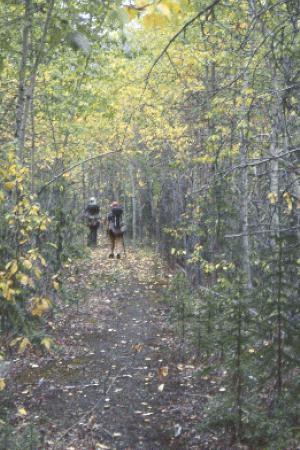
This site details a backpacking trip on the Canol Heritage Trail by , Dave Cobb and Roberta Cobb from August 9-22, 1998. Steve and Dave took the photographs. See the Canol Heritage Trail web site for more information about the trail, maps, etc. If you are thinking about hiking this thing, I suggest you take a look at some of our hints, tips and warnings. Despite my generally repellant nature, we actually did see some animals. When my head wasn't between my knees, I got a few nice shots of the Canol from the airplane. The town of Norman Wells used my photographs in an advertisement for their community.

Day 1, August 9, 16 miles, Macmillan Pass Airstrip, Yukon (MP 238) to Tsichu River (MP 222)
Day 2, August 10, 14 miles, Tsichu River (MP 222) to Pump Station #6 (MP 208)
Day 3, August 11, 24 miles, Pump Station #6 (MP 208) to Ekwi River (MP 184)
Day 4, August 12, 22 miles, Ekwi River (MP 184) to Godlin River (MP 162)
Day 5, August 13, 19 miles, Godlin River (MP 162) to Godlin River (MP 143)
Day 6, August 14, 14 miles, Godlin River (MP 143) to After Twitya River (MP 129)
Day 7, August 15, 21 miles, After Twitya River (MP 129) to Pump Station #4 (MP 108)
Day 8, August 16, 18 miles, Pump Station #4 (MP 108) to Andy Creek (MP 90)
Day 9, August 17, 15 miles, Andy Creek (MP 90) to Pump Station #3 (MP 75)
Day 10, August 18, 20 miles, Pump Station #3 (MP 75) to Limestone Plateau (MP 55)
Day 11, August 19, 15 miles, Limestone Plateau (MP 55) to Dodo Creek (MP 40)
Day 12, August 20, 15 miles, Dodo Creek (MP 40) to Carcajou River (MP 25)
Day 13, August 21, 20 miles, Carcajou River (MP 25) to Mackenzie River (MP 5)
Day 14, August 22, 0 miles, Mackenzie River (MP 5) to Norman Wells (MP 0)